R has a number of libraries that can be used for plotting. They can be combined with open GIS data to create custom maps.
In this post I’ll demonstrate how to create several maps.
First step is getting shapefiles that will be used to create maps. One of the sources could be this site, but any source with open .shp files will do.
Here I’ll focus on country level (administrative) data for Poland.
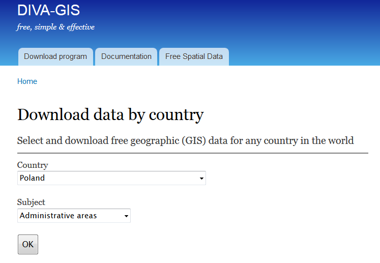
If you follow the link to diva-gis you should see the following screen:
I’ll plot powiats and voivodeships which are first- and second-level administrative subdivisions in Poland.
After downloading and unzipping POL_adm.zip into your working directory in R you will be able to use the scripts underneath to recreate the maps.
The simplest map is using only the shapefiles without any extra background.
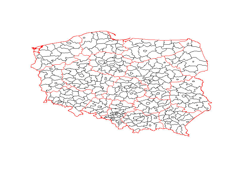
Clearly, it’s not the most attractive map, but it’s still informative.
It was generated with the following code:
Nicer maps can be generated with ggmap package. This package allows adding a shapefile overlay onto Google Maps or OSM. In this example I used get_googlemap function, but if you want other background then you should use get_map with appropriate arguments.
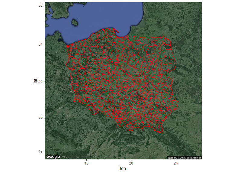
Code used to generate the map above:
And last, but not least is my favourite interactive map created with leaflet.
Snippet:
> sessionInfo()

R version 3.2.4 Revised (2024-03-16 r70336)

Platform: x86_64-w64-mingw32/x64 (64-bit)

Running under: Windows 7 x64 (build 7601) Service Pack 1
locale:
[1] LC_COLLATE=English_United Kingdom.1252 LC_CTYPE=English_United Kingdom.1252
[3] LC_MONETARY=English_United Kingdom.1252 LC_NUMERIC=C
[5] LC_TIME=English_United Kingdom.1252
attached base packages:
[1] stats graphics grDevices utils datasets methods base
other attached packages:
[1] rgdal_1.1-7 ggmap_2.6.1 ggplot2_2.1.0 leaflet_1.0.1 maptools_0.8-39
[6] sp_1.2-2
loaded via a namespace (and not attached):
[1] Rcpp_0.12.4 magrittr_1.5 maps_3.1.0 munsell_0.4.3
[5] colorspace_1.2-6 geosphere_1.5-1 lattice_0.20-33 rjson_0.2.15
[9] jpeg_0.1-8 stringr_1.0.0 plyr_1.8.3 tools_3.2.4
[13] grid_3.2.4 gtable_0.2.0 png_0.1-7 htmltools_0.3.5
[17] yaml_2.1.13 digest_0.6.9 RJSONIO_1.3-0 reshape2_1.4.1
[21] mapproj_1.2-4 htmlwidgets_0.6 labeling_0.3 stringi_1.0-1
[25] RgoogleMaps_1.2.0.7 scales_0.4.0 jsonlite_0.9.19 foreign_0.8-66
[29] proto_0.3-10